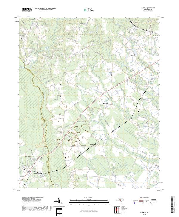
2022 Map of Wagram
USGS Topo · Published 2022About this map
The Lumber River and Drowning Creek serve as the natural border between Scotland and Hoke counties, defining a landscape of sprawling wetlands and low-lying drainages. This recent survey of the region captures the intricate hydrology of the area, where the Big Middle Swamp, Little Raft Swamp, and Raft Swamp dominate the eastern reaches. The map documents established communities like Wagram and Raeford, alongside smaller residential pockets such as New Town, Crump Town, and Bowmore.
Find a feature on this map
122 named features on this map. Tap any name to fly to it.
Don’t see what you’re looking for? This feature index may not catch every label — zoom into the map to look around manually.
Map Details
Editions of this 2022 Wagram Map
This is the sole edition of this map. No revisions or reprints were ever made.
Historical Maps of Raeford Through Time
4 maps found