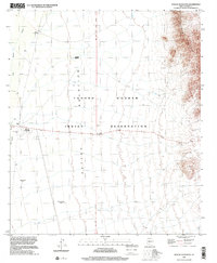
1996 Map of Wahak Hotrontk
USGS Topo · Published 2001About this map
Wahak Hotrontk serves as a primary settlement within the Tohono O'odham Indian Reservation during the late twentieth century. This desert landscape is defined by the broad Quijotoa Valley, which runs through the center of the quadrangle, flanked to the east by the rising terrain of Sierra Blanca. The map captures a transition in land use, noting established community centers alongside archaeological or historical footprints like Stotonyak (Site) and Ahan Owuch (Site).
Find a feature on this map
17 named features on this map. Tap any name to fly to it.
Don’t see what you’re looking for? This feature index may not catch every label — zoom into the map to look around manually.
Map Details
Editions of this 1996 Wahak Hotrontk Map
This is the sole edition of this map. No revisions or reprints were ever made.
Other maps of this area

1953 · Ajo
USGS Topo · 1:250,000

1957 · Ajo
USGS Topo · 1:250,000

1958 · Ajo
USGS Topo · 1:250,000

1962 · Ajo
USGS Topo · 1:250,000

1963 · Ajo
USGS Topo · 1:250,000

1963 · Gu Achi
USGS Topo · 1:62,500

1963 · Quijotoa Mts
USGS Topo · 1:62,500

1963 · Cimarron Peak
USGS Topo · 1:62,500

1963 · Pisinimo
USGS Topo · 1:62,500

1967 · Ajo
USGS Topo · 1:250,000
Featured Places
- Komak Wuacho, Pisinemo District
- Ahan Owuch, Pisinemo District
- Stotonyak, Pisinemo District
- Wahak Hotrontk, Pisinemo District
- Pisinemo District, AZ