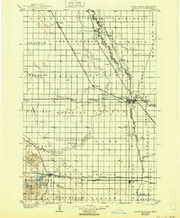
1904 Map of Wahpeton
USGS Topo · Published 1943About this map
Wahpeton and Breckenridge serve as the focal point of this Red River Valley survey, marking the vital confluence of the Red River of the North and the Bois de Sioux River. The landscape is a complex grid of rail-driven commerce, where the Great Northern Line, Chicago Milwaukee and St. Paul R. R., and Northern Pacific R. R. converge to move agricultural goods from prairie settlements like Colfax, Abercrombie, and Fairmount. In the southwest corner, the terrain breaks from its flat river-bottom character near Hankinson, featuring a cluster of water bodies including Willard Lake and Elsie Lake. The intricate meanders of the Wild Rice River contrast sharply with the rigid township boundaries and straight-line railway spurs that defined North Dakota and Minnesota development at the turn of the century.
Find a feature on this map
75 named features on this map. Tap any name to fly to it.
Don’t see what you’re looking for? This feature index may not catch every label — zoom into the map to look around manually.
Map Details
Editions of this 1904 Wahpeton Map
2 editions found
Other maps of this area

1895 · Fargo
USGS Topo · 1:125,000

1895 · Casselton
USGS Topo · 1:125,000

1897 · Fargo
USGS Topo · 1:125,000

1897 · Casselton
USGS Topo · 1:125,000

1904 · Wahpeton
USGS Topo · 1:125,000

1907 · Wyndmere
USGS Topo · 1:125,000

1915 · White Rock
USGS Topo · 1:62,500

1917 · New Effington
USGS Topo · 1:62,500

1918 · White Rock
USGS Topo · 1:62,500

1919 · Rothsay
USGS Topo · 1:62,500