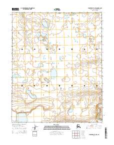
2014 Map of Wainwright A-2 SW
USGS Topo · Published 2014About this map
The low-lying Arctic coastal plain of the North Slope is defined by its complex network of seasonal drainages and thermokarst lakes. The Kaolak River flows through the southeastern corner of the quadrangle, serving as a primary hydrological feature in a landscape otherwise dominated by smaller tributary systems like Katrikorak Cr and Adrigon Cr. This 2014 survey illustrates the intricate pattern of standing water and wetlands that characterize the permafrost-underlain terrain between the Beaufort Sea and the foothills of the Brooks Range. The lack of man-made structures or improved roads highlights the wilderness character of the region, where topographical changes are subtle and the primary landmarks are the shifting banks of the river and its creeks.
Find a feature on this map
7 named features on this map. Tap any name to fly to it.
Don’t see what you’re looking for? This feature index may not catch every label — zoom into the map to look around manually.
Map Details
Editions of this 2014 Wainwright A-2 SW Map
This is the sole edition of this map. No revisions or reprints were ever made.
Other maps of this area

1951 · Utukok River
USGS Topo · 1:250,000

1951 · Wainwright
USGS Topo · 1:250,000

1955 · Wainwright
USGS Topo · 1:250,000

1955 · Wainwright A-2
USGS Topo · 1:63,360
1955 · Utukok River D-3
USGS Topo · 1:63,360
1955 · Wainwright A-3
USGS Topo · 1:63,360

1956 · Utukok River
USGS Topo · 1:250,000

1964 · Wainwright
USGS Topo · 1:250,000

1965 · Utukok River
USGS Topo · 1:250,000
1984 · Utukok River D-2
USGS Topo · 1:63,360