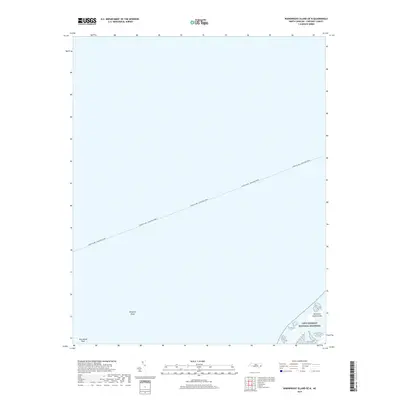
2019 Map of Wainwright Island OE N
USGS Topo · Published 2019About this map
Cape Lookout National Seashore defines the southeastern corner of this maritime landscape in Carteret County, North Carolina. This map documents a critical segment of the Outer Banks near the entrance to Pamlico Sound, where the Cedar Island - Ocracoke Ferry route bisects the open waters. The chart is primarily composed of the sound's aquatic expanse, providing essential details for maritime history and navigation enthusiasts. Submerged and emerging features such as Kingfish Shoal and Hog Island Reef illustrate the shifting sands and underwater topography of this coastal environment. Near the shoreline, the Kathryne Jane Islands represent the small, fragile landmasses that characterize this protected coastal wilderness, offering a snapshot of the region's geography before further natural coastal erosion and deposition.
Find a feature on this map
5 named features on this map. Tap any name to fly to it.
Don’t see what you’re looking for? This feature index may not catch every label — zoom into the map to look around manually.
Map Details
Editions of this 2019 Wainwright Island OE N Map
This is the sole edition of this map. No revisions or reprints were ever made.
Other maps of this area

1948 · Portsmouth
USGS Topo · 1:24,000

1948 · North Bay
USGS Topo · 1:24,000

1949 · Atlantic
USGS Topo · 1:24,000

1950 · Portsmouth
USGS Topo · 1:24,000

1950 · North Bay
USGS Topo · 1:24,000
1951 · Atlantic
USGS Topo · 1:24,000

1953 · Rocky Mount
USGS Topo · 1:250,000

1953 · Beaufort
USGS Topo · 1:250,000

1954 · Rocky Mount
USGS Topo · 1:250,000

1954 · Beaufort
USGS Topo · 1:250,000