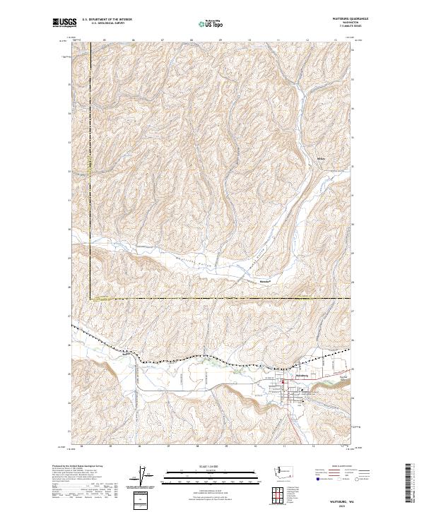
2023 Map of Waitsburg
USGS Topo · Published 2023About this map
Waitsburg serves as the focal point of this survey, positioned at the confluence of the Touchet River and Coppei Creek. The town's layout is meticulously detailed, showing the street grid from W 2nd St to E 8th St, alongside local landmarks like the Waitsburg City Cem and the Independent Order of Odd Fellows Cem. The surrounding Touchet Valley is characterized by a series of deeply carved drainages with evocative local names such as Whetstone Hollow, Whoopemup Hollow, and Kellogg Hollow.
Find a feature on this map
61 named features on this map. Tap any name to fly to it.
Don’t see what you’re looking for? This feature index may not catch every label — zoom into the map to look around manually.
Map Details
Editions of this 2023 Waitsburg Map
This is the sole edition of this map. No revisions or reprints were ever made.
Other maps of this area

1919 · Walla Walla
USGS Topo · 1:125,000

1921 · Walla Walla
USGS Topo · 1:125,000

1953 · Walla Walla
USGS Topo · 1:250,000

1958 · Walla Walla
USGS Topo · 1:250,000

1966 · Dixie
USGS Topo · 1:24,000
1966 · Coppei
USGS Topo · 1:24,000

1966 · Valley Grove
USGS Topo · 1:24,000
1967 · Prescott
USGS Topo · 1:24,000

1967 · Waitsburg NW
USGS Topo · 1:24,000
1967 · Waitsburg
USGS Topo · 1:24,000