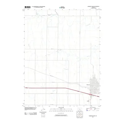
2010 Map of WaKeeney West
USGS Topo · Published 2010About this map
WaKeeney anchors this section of Trego County, positioned where the grid of the High Plains meets the meandering drainage of the Saline River. The western half of the town is depicted in high detail, showing the established residential blocks and transit corridors that define this regional hub. To the north, the terrain transitions into more dramatic relief as the North Fork Saline River and Trego Creek carve through the landscape, eventually leading to Hay Hollow. This interface between the built environment of the town and the natural waterways is a defining characteristic of the quadrangle. For those researching local heritage, the Saline Valley Cemetery sits isolated in the north, while the Trego WaKeeney Airport and thoroughfares like Golden Belt Rd and Old Hwy 40 trace the area's ongoing importance as a transportation crossroads.
Find a feature on this map
19 named features on this map. Tap any name to fly to it.
Don’t see what you’re looking for? This feature index may not catch every label — zoom into the map to look around manually.
Map Details
Editions of this 2010 WaKeeney West Map
This is the sole edition of this map. No revisions or reprints were ever made.
Other maps of this area

1893 · Ellis
USGS Topo · 1:125,000

1893 · Hill
USGS Topo · 1:125,000

1954 · Goodland
USGS Topo · 1:250,000

1955 · Great Bend
USGS Topo · 1:250,000

1955 · Scott City
USGS Topo · 1:250,000

1955 · Beloit
USGS Topo · 1:250,000

1956 · Goodland
USGS Topo · 1:250,000

1957 · Goodland
USGS Topo · 1:250,000

1957 · Great Bend
USGS Topo · 1:250,000

1958 · Great Bend
USGS Topo · 1:250,000