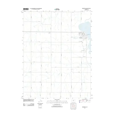
2012 Map of Wakefield
USGS Topo · Published 2012About this map
Wakefield sits at the edge of the expansive Milford Lake reservoir in Clay County, serving as the primary hub for this rural Kansas landscape. The town is organized around a grid including Knollwood St, Grove St, and Elm St, with the local Po located near the town center. The surrounding countryside reflects a meticulous agricultural grid defined by roads like Osage Rd and Prairie Rd, while natural drainages such as Cane Cr and Quimby Cr carve through the plains. Local history is anchored by several burial sites, including Saint Johns Cem and Madura Cem, which sit alongside the small settlement of Bateham. To the south of Wakefield, the Kansas Arboretum provides a focused point of botanical interest near the winding shoreline of the lake.
Find a feature on this map
43 named features on this map. Tap any name to fly to it.
Don’t see what you’re looking for? This feature index may not catch every label — zoom into the map to look around manually.
Map Details
Editions of this 2012 Wakefield Map
This is the sole edition of this map. No revisions or reprints were ever made.
Other maps of this area

1886 · Junction City
USGS Topo · 1:125,000

1889 · Junction City
USGS Topo · 1:125,000

1891 · Clay Center
USGS Topo · 1:125,000

1894 · Junction City
USGS Topo · 1:125,000

1947 · Fort Riley
USGS Topo · 1:62,500

1950 · Alida
USGS Topo · 1:24,000

1951 · Milford
USGS Topo · 1:24,000

1955 · Milford
USGS Topo · 1:24,000
1955 · Alida
USGS Topo · 1:24,000

1955 · Manhattan
USGS Topo · 1:250,000