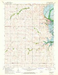
1964 Map of Wakefield
USGS Topo · Published 1966About this map
The town of Wakefield stands as the central hub of this mid-1960s landscape, positioned where the Republican River begins its transformation. Blue hatching across the terrain indicates areas planned for submergence by the rising Milford Reservoir, a significant engineering project captured here in a state of controlled inundation. This period of transition is well-documented, showing the original river course and the adjacent Sandpit before the waters reached their full level.
Find a feature on this map
21 named features on this map. Tap any name to fly to it.
Don’t see what you’re looking for? This feature index may not catch every label — zoom into the map to look around manually.
Map Details
Editions of this 1964 Wakefield Map
This is the sole edition of this map. No revisions or reprints were ever made.
Other maps of this area

1886 · Junction City
USGS Topo · 1:125,000

1889 · Junction City
USGS Topo · 1:125,000

1891 · Clay Center
USGS Topo · 1:125,000

1894 · Junction City
USGS Topo · 1:125,000

1947 · Fort Riley
USGS Topo · 1:62,500

1950 · Alida
USGS Topo · 1:24,000

1951 · Milford
USGS Topo · 1:24,000

1955 · Milford
USGS Topo · 1:24,000
1955 · Alida
USGS Topo · 1:24,000

1955 · Manhattan
USGS Topo · 1:250,000