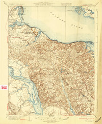
1932 Map of Wakefield
USGS Topo · Published 1932About this map
George Washington Birthplace National Monument serves as the focal point of this northern Virginia landscape along the Potomac River. The terrain is defined by dramatic riverfront features such as the Stratford Cliffs and Nomini Cliffs, while the interior is dotted with small rural communities and family-named landmarks like Monroe Hall and Latanes. The map reveals a transition in transportation, showing both the established river commerce at sites like Smith Mount Landing and Carters Wharf alongside the emerging Popes Creek Highway.
Find a feature on this map
104 named features on this map. Tap any name to fly to it.
Don’t see what you’re looking for? This feature index may not catch every label — zoom into the map to look around manually.
Map Details
Editions of this 1932 Wakefield Map
2 editions found
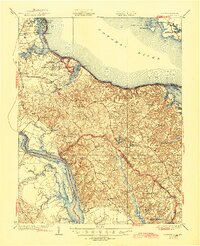
Other maps of this area

1889 · Fredericksburg
USGS Topo · 1:125,000

1892 · Leonardtown
USGS Topo · 1:62,500

1892 · Fredericksburg
USGS Topo · 1:125,000

1892 · Piney Point
USGS Topo · 1:62,500

1892 · Montross
USGS Topo · 1:62,500

1894 · Wicomico
USGS Topo · 1:62,500

1894 · Fredericksburg
USGS Topo · 1:125,000

1894 · Piney Point
USGS Topo · 1:62,500

1895 · Wicomico
USGS Topo · 1:62,500

1895 · Leonardtown
USGS Topo · 1:62,500