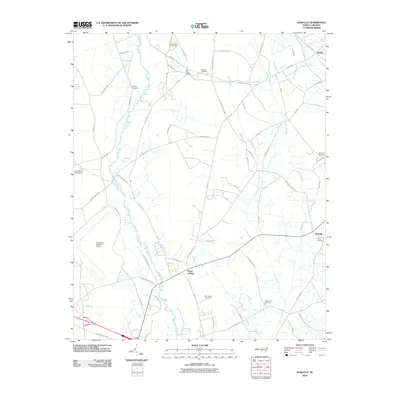
2010 Map of Wakulla
USGS Topo · Published 2010About this map
Floral College and the winding course of the Lumber River anchor this portion of Robeson County, North Carolina. The landscape is characterized by extensive drainage networks, including Gum Swamp, Jordan Swamp, and Long Swamp, which weave between agricultural plots and small settlements like Wakulla and Duffies. The presence of the Laurinburg-Maxton Airport in the southwest corner reflects the region's mid-century modernization and its role in regional transport.
Find a feature on this map
70 named features on this map. Tap any name to fly to it.
Don’t see what you’re looking for? This feature index may not catch every label — zoom into the map to look around manually.
Map Details
Editions of this 2010 Wakulla Map
This is the sole edition of this map. No revisions or reprints were ever made.
Other maps of this area

1949 · Wagram
USGS Topo · 1:24,000

1949 · Laurinburg
USGS Topo · 1:24,000

1949 · Silver Hill
USGS Topo · 1:24,000

1949 · Wakulla
USGS Topo · 1:24,000

1949 · Laurinburg
USGS Topo · 1:62,500

1953 · Florence
USGS Topo · 1:250,000

1954 · Florence
USGS Topo · 1:250,000

1957 · Laurinburg
USGS Topo · 1:24,000

1971 · Johns
USGS Topo · 1:24,000
1972 · Raeford
USGS Topo · 1:24,000