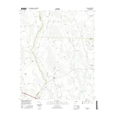
2016 Map of Wakulla
USGS Topo · Published 2016About this map
The Lumber River forms a winding natural border between Scotland and Robeson counties, defining the western edge of this agricultural landscape. The settlement of Maxton anchors the southern boundary, while the historic community of Floral College sits centrally, a name rooted in the region's 19th-century educational heritage. The terrain is characterized by expansive swamp systems, including Gum Swamp, Jordan Swamp, and Long Swamp, which weave between family-named farm roads and ancestral lands. Genealogists will find a high density of small family and community burial grounds, such as McLean Cem, Smith Cem, and McPhatter Cem, scattered across the rural tracts. To the west, the Laurinburg-Maxton Airport occupies a significant footprint, reflecting the area's mid-century transition toward larger-scale infrastructure alongside its traditional reliance on the river and rail network.
Find a feature on this map
102 named features on this map. Tap any name to fly to it.
Don’t see what you’re looking for? This feature index may not catch every label — zoom into the map to look around manually.
Map Details
Editions of this 2016 Wakulla Map
This is the sole edition of this map. No revisions or reprints were ever made.
Other maps of this area

1949 · Wagram
USGS Topo · 1:24,000

1949 · Laurinburg
USGS Topo · 1:24,000

1949 · Silver Hill
USGS Topo · 1:24,000

1949 · Wakulla
USGS Topo · 1:24,000

1949 · Laurinburg
USGS Topo · 1:62,500

1953 · Florence
USGS Topo · 1:250,000

1954 · Florence
USGS Topo · 1:250,000

1957 · Laurinburg
USGS Topo · 1:24,000

1971 · Johns
USGS Topo · 1:24,000
1972 · Raeford
USGS Topo · 1:24,000