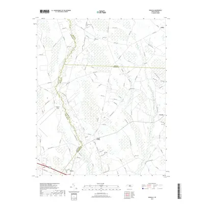
2019 Map of Wakulla
USGS Topo · Published 2019About this map
Floral College serves as a central landmark in this 2019 topography, situated near the intersection of several regional roads in the flat coastal plain. The landscape is heavily defined by its complex hydrology, with the winding Lumber River forming a natural boundary to the west, while numerous swamps such as Gum Swamp, Jordan Swamp, and Long Swamp pattern the eastern portion of the quadrangle.
Find a feature on this map
104 named features on this map. Tap any name to fly to it.
Don’t see what you’re looking for? This feature index may not catch every label — zoom into the map to look around manually.
Map Details
Editions of this 2019 Wakulla Map
This is the sole edition of this map. No revisions or reprints were ever made.
Other maps of this area

1949 · Wagram
USGS Topo · 1:24,000

1949 · Laurinburg
USGS Topo · 1:24,000

1949 · Silver Hill
USGS Topo · 1:24,000

1949 · Wakulla
USGS Topo · 1:24,000

1949 · Laurinburg
USGS Topo · 1:62,500

1953 · Florence
USGS Topo · 1:250,000

1954 · Florence
USGS Topo · 1:250,000

1957 · Laurinburg
USGS Topo · 1:24,000

1971 · Johns
USGS Topo · 1:24,000
1972 · Raeford
USGS Topo · 1:24,000