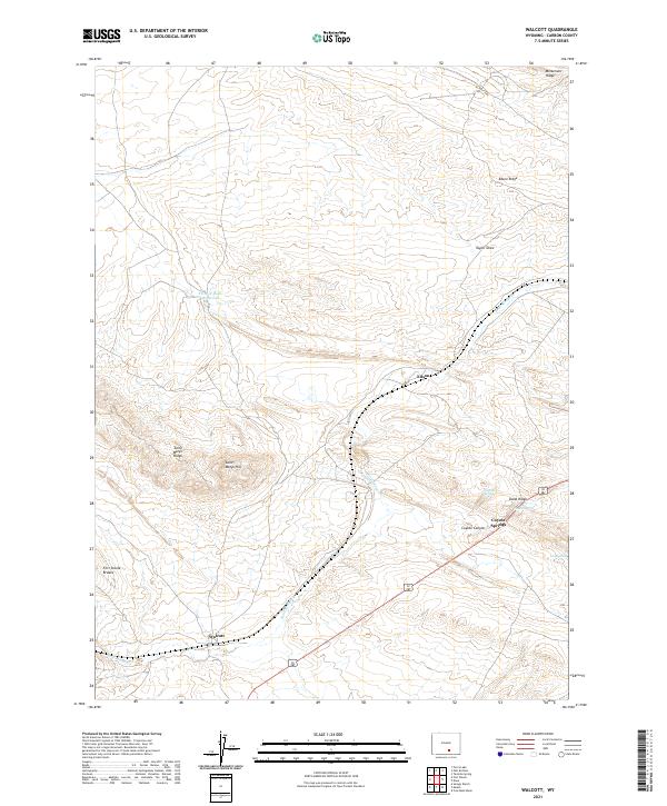
2021 Map of Walcott
USGS Topo · Published 2021About this map
Walcott and Edson serve as the primary markers of human settlement in this high-plains landscape in Carbon County, Wyoming. The terrain is characterized by a series of prominent ridges and draws, including Saint Marys Ridge and Edson Ridge, which orient the local geography. Water sources are scarce but critical, evidenced by the presence of Point of Rocks Reservoir and several natural springs such as Sulphur Spring and Coyote Spring.
Find a feature on this map
21 named features on this map. Tap any name to fly to it.
Don’t see what you’re looking for? This feature index may not catch every label — zoom into the map to look around manually.
Map Details
Editions of this 2021 Walcott Map
This is the sole edition of this map. No revisions or reprints were ever made.
Other maps of this area

1893 · Fort Steele
USGS Topo · 1:125,000

1914 · Hanna
USGS Topo · 1:62,500

1914 · Walcott
USGS Topo · 1:62,500

1954 · Rawlins
USGS Topo · 1:250,000

1955 · Coal Bank Basin
USGS Topo · 1:24,000

1955 · Meads
USGS Topo · 1:24,000

1955 · Savage Ranch
USGS Topo · 1:24,000

1958 · Rawlins
USGS Topo · 1:250,000

1962 · Rawlins
USGS Topo · 1:250,000

1967 · Rawlins
USGS Topo · 1:250,000