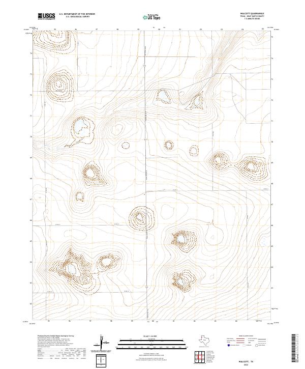
2022 Map of Walcott
USGS Topo · Published 2022About this map
Deaf Smith County's high plains terrain is defined by its characteristic playa basins and a geometric grid of rural transport routes. The north-south corridor of Ranch Rd 1412 serves as the primary spine for this section of the Panhandle, intersecting a series of numbered local roads that delineate the agricultural landscape. These routes, including Co Rd 12, Co Rd 13, and Co Rd 10, follow the section lines of the original land surveys, creating a distinct pattern of large-scale ranching and farming tracts. The topographic data from the National Elevation Dataset reveals subtle depressions across the plateau, many of which contain intermittent wetlands typical of this semi-arid region. Unlike more densely settled areas, this landscape remains focused on the infrastructure of movement and the management of open range, with the road network providing the only named landmarks across the high plains.
Find a feature on this map
9 named features on this map. Tap any name to fly to it.
Don’t see what you’re looking for? This feature index may not catch every label — zoom into the map to look around manually.
Map Details
Editions of this 2022 Walcott Map
This is the sole edition of this map. No revisions or reprints were ever made.
Other maps of this area

1954 · Tucumcari
USGS Topo · 1:250,000

1954 · Clovis
USGS Topo · 1:250,000

1958 · Clovis
USGS Topo · 1:250,000

1958 · Tucumcari
USGS Topo · 1:250,000

1966 · Simms
USGS Topo · 1:24,000

1966 · Sand Point
USGS Topo · 1:24,000

1966 · Norton Lake
USGS Topo · 1:24,000

1970 · Chalk Hill
USGS Topo · 1:24,000

1971 · Mustang Lake
USGS Topo · 1:24,000

1971 · Bootleg
USGS Topo · 1:24,000