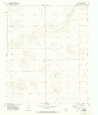
1971 Map of Walcott
USGS Topo · Published 1973About this map
Walcott and the nearby settlement of Valentine anchor this 1971 survey of the High Plains in Deaf Smith County. The landscape is defined by the winding course of Palo Duro Creek as it cuts through the terrain in the northeastern portion of the quadrangle. Outside of these primary hubs, the map reveals a sparsely populated agricultural or ranching environment where the distribution of water was critical to local survival and industry. This importance is underscored by the numerous scattered Well and Wells labels across the sheet, marking vital points of groundwater access on the flat Texas Panhandle. The topography is meticulously detailed with five-foot contour intervals, capturing the subtle depressions and rises that often escape the eye but dictate the flow of seasonal drainage into the creek system.
Find a feature on this map
5 named features on this map. Tap any name to fly to it.
Don’t see what you’re looking for? This feature index may not catch every label — zoom into the map to look around manually.
Map Details
Editions of this 1971 Walcott Map
This is the sole edition of this map. No revisions or reprints were ever made.
Other maps of this area

1954 · Tucumcari
USGS Topo · 1:250,000

1954 · Clovis
USGS Topo · 1:250,000

1958 · Clovis
USGS Topo · 1:250,000

1958 · Tucumcari
USGS Topo · 1:250,000

1966 · Simms
USGS Topo · 1:24,000

1966 · Sand Point
USGS Topo · 1:24,000

1966 · Norton Lake
USGS Topo · 1:24,000

1970 · Chalk Hill
USGS Topo · 1:24,000

1971 · Mustang Lake
USGS Topo · 1:24,000

1971 · Bootleg
USGS Topo · 1:24,000