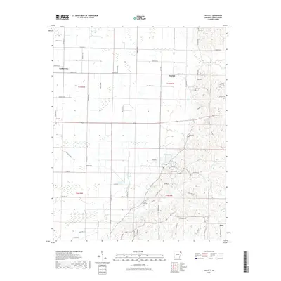
2020 Map of Walcott
USGS Topo · Published 2020About this map
Walcott and Stanford serve as central points in this portion of Greene County, where the flat agricultural bottomlands meet the rising topography to the east. The transition from the straight, gridded road network of the plains—dominated by features like Main Ditch and the settlement of Faulknerville—to the winding routes of the higher ground illustrates the area's diverse geography. This upland region is notable for its high density of small family and community burial grounds, including Morrow Cem, Moore Cem, and Owen's Chapel Cem. Near the center of the sheet, Walcot Lake provides a local landmark adjacent to the town. The southern edge is defined by the community of Finch and the drainage of Poplar Cr, while the crossroads at Light mark the western reaches. This survey captures a landscape where established farming communities and rural church sites like Mount Zion Cem remain central to the local identity.
Find a feature on this map
81 named features on this map. Tap any name to fly to it.
Don’t see what you’re looking for? This feature index may not catch every label — zoom into the map to look around manually.
Map Details
Editions of this 2020 Walcott Map
This is the sole edition of this map. No revisions or reprints were ever made.
Other maps of this area

1932 · Walnut Ridge
USGS Topo · 1:62,500

1935 · Sedgwick
USGS Topo · 1:62,500

1935 · Walnut Ridge
USGS Topo · 1:62,500

1939 · Jonesboro
USGS Topo · 1:62,500

1940 · Gainesville
USGS Topo · 1:62,500

1953 · Memphis
USGS Topo · 1:250,000

1956 · Memphis
USGS Topo · 1:250,000

1957 · Poplar Bluff
USGS Topo · 1:250,000

1958 · Jonesboro
USGS Topo · 1:62,500

1958 · Gainesville
USGS Topo · 1:62,500