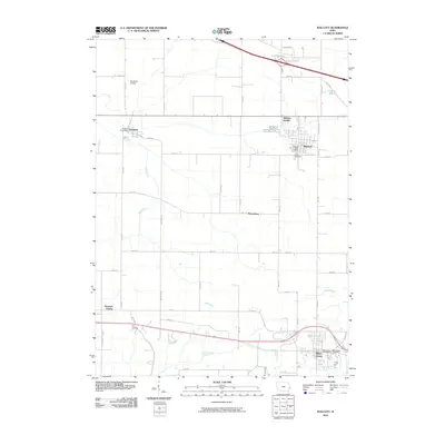
2010 Map of Walcott
USGS Topo · Published 2010About this map
Walcott and Blue Grass anchor this Scott County landscape, representing a region defined by agricultural heritage and structured development. The map details a transition from the village centers to the outlying farming communities of Petersburg and Pleasant Prairie. Grounded in the local topography, Mud Creek and Duck Creek carve distinct paths across the terrain, while Lamps Pond sits in the northeast corner. Cultural and genealogical markers are plentiful, including the Walcott Cemetery, Parr Cemetery, and Blue Grass Cemetery, which serve as vital records of the area's residents. Transport and infrastructure are represented by the Workman Airfield and the post offices of Stockton, Walcott, and Blue Grass, reflecting the sustained community network that links these eastern Iowa settlements.
Find a feature on this map
46 named features on this map. Tap any name to fly to it.
Don’t see what you’re looking for? This feature index may not catch every label — zoom into the map to look around manually.
Map Details
Editions of this 2010 Walcott Map
This is the sole edition of this map. No revisions or reprints were ever made.
Other maps of this area

1890 · Durant
USGS Topo · 1:62,500

1891 · Davenport
USGS Topo · 1:62,500

1894 · Durant
USGS Topo · 1:62,500

1894 · Davenport
USGS Topo · 1:62,500

1901 · Rock Island
USGS Topo · 1:125,000

1910 · Rock Island
USGS Topo · 1:125,000

1912 · Milan
USGS Topo · 1:62,500

1916 · Edgington
USGS Topo · 1:62,500

1938 · Edgington
USGS Topo · 1:62,500

1944 · Milan
USGS Topo · 1:62,500