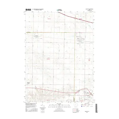
2015 Map of Walcott
USGS Topo · Published 2015About this map
Walcott and Blue Grass anchor the eastern and southern portions of this Scott County landscape, where the agricultural grid meets the expansion of local towns. The area is defined by its drainage systems, with the winding paths of Mud Cr and Duck Cr cutting through the section lines of the Public Land Survey System. Smaller settlements like Stockton and Pleasant Prairie illustrate the distributed nature of early Iowa development, while the placement of the Walcott Cem, Parr Cem, and Blue Grass Cem provides essential touchpoints for genealogical research and local history. Transportation remains a central theme, with established routes such as W Lincoln St and E Telegraph Rd serving as modern corridors that follow long-standing property and township boundaries.
Find a feature on this map
49 named features on this map. Tap any name to fly to it.
Don’t see what you’re looking for? This feature index may not catch every label — zoom into the map to look around manually.
Map Details
Editions of this 2015 Walcott Map
This is the sole edition of this map. No revisions or reprints were ever made.
Other maps of this area

1890 · Durant
USGS Topo · 1:62,500

1891 · Davenport
USGS Topo · 1:62,500

1894 · Durant
USGS Topo · 1:62,500

1894 · Davenport
USGS Topo · 1:62,500

1901 · Rock Island
USGS Topo · 1:125,000

1910 · Rock Island
USGS Topo · 1:125,000

1912 · Milan
USGS Topo · 1:62,500

1916 · Edgington
USGS Topo · 1:62,500

1938 · Edgington
USGS Topo · 1:62,500

1944 · Milan
USGS Topo · 1:62,500