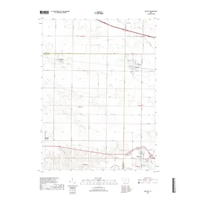
2018 Map of Walcott
USGS Topo · Published 2018About this map
Walcott and Blue Grass anchor this 2018 survey of the borderlands between Scott and Muscatine counties. The landscape is defined by the regular grid of rural roads and the drainage of Mud Cr and Duck Cr, which cut through the agricultural fields of eastern Iowa. The infrastructure of the Western railroad corridor remains a central feature of the northern settlements, linking Stockton and Walcott to the broader regional economy. Family history researchers will find several well-established burial grounds preserved here, including Walcott Cem and Blue Grass Cem, along with the more isolated Parr Cem situated near the intersection of several local routes. The map illustrates the contemporary layout of these small communities as they maintain their identities amidst the expansive farms of the Iowa prairie.
Find a feature on this map
51 named features on this map. Tap any name to fly to it.
Don’t see what you’re looking for? This feature index may not catch every label — zoom into the map to look around manually.
Map Details
Editions of this 2018 Walcott Map
This is the sole edition of this map. No revisions or reprints were ever made.
Other maps of this area

1890 · Durant
USGS Topo · 1:62,500

1891 · Davenport
USGS Topo · 1:62,500

1894 · Durant
USGS Topo · 1:62,500

1894 · Davenport
USGS Topo · 1:62,500

1901 · Rock Island
USGS Topo · 1:125,000

1910 · Rock Island
USGS Topo · 1:125,000

1912 · Milan
USGS Topo · 1:62,500

1916 · Edgington
USGS Topo · 1:62,500

1938 · Edgington
USGS Topo · 1:62,500

1944 · Milan
USGS Topo · 1:62,500