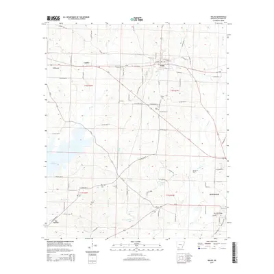
2014 Map of Waldo
USGS Topo · Published 2014About this map
Waldo serves as a central hub on this Arkansas landscape, where the intersection of Us-371 and Ar-98 anchors a network of rural roads and timbered corridors. To the southeast, the outskirts of Magnolia emerge, including the residential developments of Hurricane Ridge. The region's industrial character is defined by the Big Creek Oil and Gas Field, indicating the subsurface resources that have long shaped the local economy.
Find a feature on this map
128 named features on this map. Tap any name to fly to it.
Don’t see what you’re looking for? This feature index may not catch every label — zoom into the map to look around manually.
Map Details
Editions of this 2014 Waldo Map
This is the sole edition of this map. No revisions or reprints were ever made.
Other maps of this area

1953 · El Dorado
USGS Topo · 1:250,000

1957 · El Dorado
USGS Topo · 1:250,000

1958 · El Dorado
USGS Topo · 1:250,000

1960 · El Dorado
USGS Topo · 1:250,000

1960 · Bussey
USGS Topo · 1:24,000

1960 · Macedonia
USGS Topo · 1:24,000

1966 · Calhoun
USGS Topo · 1:24,000

1968 · Buckner
USGS Topo · 1:24,000

1968 · Lamartine
USGS Topo · 1:24,000
1968 · Falcon
USGS Topo · 1:24,000