
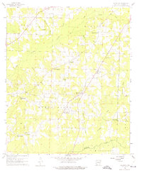
1960 Map of Macedonia
USGS Topo · Published 1961About this map
The Dorcheat Macedonia Oil Field dominates this Columbia County landscape, where the extraction industry meets a network of rural settlements and agricultural townships. The area is defined by its small, community-centered hubs like Macedonia and Philadelphia, each anchored by institutional foundations such as the Macedonia Sch, Macedonia Cem, and Philadelphia Ch. This map reveals a high density of country churches, including Pilgrims Rest Ch and New Zion Ch, which often served as the primary social and geographical landmarks for dispersed farmsteads.
Find a feature on this map
31 named features on this map. Tap any name to fly to it.
Don’t see what you’re looking for? This feature index may not catch every label — zoom into the map to look around manually.
Map Details
Editions of this 1960 Macedonia Map
4 editions found
Other maps of this area

1953 · El Dorado
USGS Topo · 1:250,000

1957 · El Dorado
USGS Topo · 1:250,000

1958 · El Dorado
USGS Topo · 1:250,000

1960 · El Dorado
USGS Topo · 1:250,000

1960 · Bussey
USGS Topo · 1:24,000
1960 · Taylor
USGS Topo · 1:24,000

1960 · Walkerville
USGS Topo · 1:24,000

1966 · Calhoun
USGS Topo · 1:24,000

1968 · Buckner
USGS Topo · 1:24,000

1968 · Waldo
USGS Topo · 1:24,000