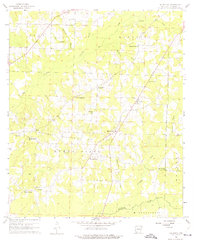
1960 Map of Macedonia
USGS Topo · Published 1975About this map
The Macedonia Oil Field dominates this 1960 survey of southwestern Arkansas, illustrating the industrial footprint of petroleum extraction within the rural landscape. The territory is organized into distinct administrative units including Clay, Magnolia, and Buena Vista, showing a pattern of dispersed settlement and resource management. This period in Columbia County history was characterized by the intersection of traditional agriculture and the energy sector, with numerous small watercourses like Atkinson Branch and Dismukes Branch threading through the developed oil field lands.
Find a feature on this map
18 named features on this map. Tap any name to fly to it.
Don’t see what you’re looking for? This feature index may not catch every label — zoom into the map to look around manually.
Map Details
Editions of this 1960 Macedonia Map
4 editions found
Other maps of this area

1953 · El Dorado
USGS Topo · 1:250,000

1957 · El Dorado
USGS Topo · 1:250,000

1958 · El Dorado
USGS Topo · 1:250,000

1960 · El Dorado
USGS Topo · 1:250,000

1960 · Bussey
USGS Topo · 1:24,000
1960 · Taylor
USGS Topo · 1:24,000

1960 · Walkerville
USGS Topo · 1:24,000

1960 · Macedonia
USGS Topo · 1:24,000

1966 · Calhoun
USGS Topo · 1:24,000

1968 · Buckner
USGS Topo · 1:24,000