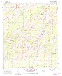
1960 Map of Macedonia
USGS Topo · Published 1983About this map
The Macedonia Oil Field dominates the central landscape of this Columbia County survey, where a complex network of pipelines and service roads underscores the region's mid-century petroleum activity. Settled around this industrial core are small rural communities and family-named land features that tell the story of South Arkansas agriculture and industry. The community of Macedonia serves as a local hub, featuring the Macedonia Sch and Macedonia Cem.
Find a feature on this map
29 named features on this map. Tap any name to fly to it.
Don’t see what you’re looking for? This feature index may not catch every label — zoom into the map to look around manually.
Map Details
Editions of this 1960 Macedonia Map
4 editions found
Other maps of this area

1953 · El Dorado
USGS Topo · 1:250,000

1957 · El Dorado
USGS Topo · 1:250,000

1958 · El Dorado
USGS Topo · 1:250,000

1960 · El Dorado
USGS Topo · 1:250,000

1960 · Bussey
USGS Topo · 1:24,000
1960 · Taylor
USGS Topo · 1:24,000

1960 · Walkerville
USGS Topo · 1:24,000

1960 · Macedonia
USGS Topo · 1:24,000

1966 · Calhoun
USGS Topo · 1:24,000

1968 · Buckner
USGS Topo · 1:24,000