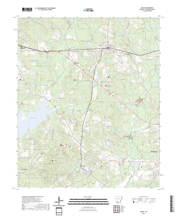
2024 Map of Waldo
USGS Topo · Published 2024About this map
Waldo serves as the primary hub of this Arkansas landscape, where residential streets like E Roselawn St and W McKissack meet the rural reaches of Columbia County. The area is defined by its numerous family and community burial grounds, including the Cedar Grove Cem and Dickson Cem, which provide essential points of reference for genealogical research. To the west, the massive Lake Columbia dominates the terrain, fed by the winding waters of Beech Creek. Small settlements and named locations such as Lumber, Jefferson, and Box Springs are connected by a web of county roads, such as Columbia Rd 58 and Columbia Rd 106. The southern portion of the map transitions toward the outskirts of Magnolia, while smaller water bodies like Fallin Lake and Weber Lake dot the central wooded areas.
Find a feature on this map
92 named features on this map. Tap any name to fly to it.
Don’t see what you’re looking for? This feature index may not catch every label — zoom into the map to look around manually.
Map Details
Editions of this 2024 Waldo Map
This is the sole edition of this map. No revisions or reprints were ever made.
Other maps of this area

1953 · El Dorado
USGS Topo · 1:250,000

1957 · El Dorado
USGS Topo · 1:250,000

1958 · El Dorado
USGS Topo · 1:250,000

1960 · El Dorado
USGS Topo · 1:250,000

1960 · Bussey
USGS Topo · 1:24,000

1960 · Macedonia
USGS Topo · 1:24,000

1966 · Calhoun
USGS Topo · 1:24,000

1968 · Buckner
USGS Topo · 1:24,000

1968 · Lamartine
USGS Topo · 1:24,000
1968 · Falcon
USGS Topo · 1:24,000