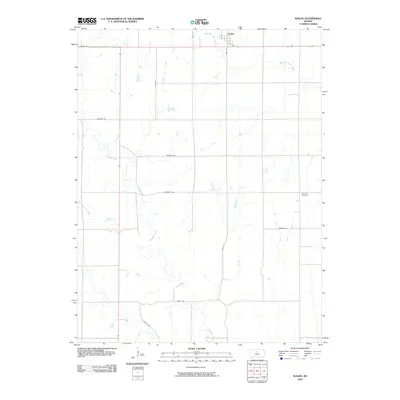
2009 Map of Waldo
USGS Topo · Published 2009About this map
Waldo sits at the northern edge of this Russell County landscape, a small community defined by its proximity to the headwaters of West Fork Wolf Creek. The terrain is shaped by a series of south-flowing drainages, most notably the meandering course of Paradise Creek and the western reach of Boswell Creek. These waterways dictate the local geography, creating a dissected prairie surface where section-line roads like Amherst Rd and Fairview Rd adapt to the natural contours of the land.
Find a feature on this map
17 named features on this map. Tap any name to fly to it.
Don’t see what you’re looking for? This feature index may not catch every label — zoom into the map to look around manually.
Map Details
Editions of this 2009 Waldo Map
This is the sole edition of this map. No revisions or reprints were ever made.
Other maps of this area

1896 · Osborne
USGS Topo · 1:125,000

1896 · Russell
USGS Topo · 1:125,000

1955 · Great Bend
USGS Topo · 1:250,000

1955 · Beloit
USGS Topo · 1:250,000

1957 · Great Bend
USGS Topo · 1:250,000

1958 · Great Bend
USGS Topo · 1:250,000

1959 · Beloit
USGS Topo · 1:250,000

1967 · Russell NW
USGS Topo · 1:24,000
1967 · Dorrance NW
USGS Topo · 1:24,000

1967 · Russell
USGS Topo · 1:24,000