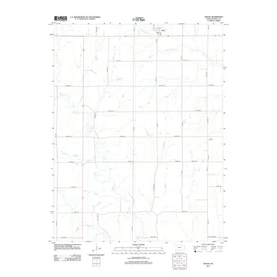
2012 Map of Waldo
USGS Topo · Published 2012About this map
Waldo is the central hub of this northern Russell County landscape, situated where local thoroughfares like Main St and Iva Ave meet. This 2012 survey illustrates a classic central Kansas drainage pattern, dominated by the winding paths of W Fork Wolf Cr and Paradise Cr, which cut through the agricultural grid. The small-town infrastructure of Waldo is highlighted by the local Po (post office), while the surrounding rural area is punctuated by family-named landmarks and historical sites such as Amherst Cem and the uniquely named Old Number 8 road. Local transport history is visible in the network of established routes like Paradise Rd and Fairport Rd, which link scattered homesteads to the town center and the varied creek valleys that define the local topography.
Find a feature on this map
30 named features on this map. Tap any name to fly to it.
Don’t see what you’re looking for? This feature index may not catch every label — zoom into the map to look around manually.
Map Details
Editions of this 2012 Waldo Map
This is the sole edition of this map. No revisions or reprints were ever made.
Other maps of this area

1896 · Osborne
USGS Topo · 1:125,000

1896 · Russell
USGS Topo · 1:125,000

1955 · Great Bend
USGS Topo · 1:250,000

1955 · Beloit
USGS Topo · 1:250,000

1957 · Great Bend
USGS Topo · 1:250,000

1958 · Great Bend
USGS Topo · 1:250,000

1959 · Beloit
USGS Topo · 1:250,000

1967 · Russell NW
USGS Topo · 1:24,000
1967 · Dorrance NW
USGS Topo · 1:24,000

1967 · Russell
USGS Topo · 1:24,000