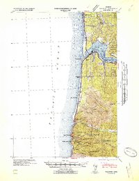
1942 Map of Waldport
USGS Topo · Published 1942About this map
Waldport serves as the central hub of this coastal survey, situated where the Alsea River empties into Alsea Bay. The landscape is defined by the sharp transition from the Pacific shoreline to the dense timberlands of the Siuslaw National Forest. Inland, the map reveals the operational infrastructure of the era, including a CCC Camp and the Waldport Ranger Station, reflecting federal land management and labor programs during the early 1940s.
Find a feature on this map
29 named features on this map. Tap any name to fly to it.
Don’t see what you’re looking for? This feature index may not catch every label — zoom into the map to look around manually.
Map Details
Editions of this 1942 Waldport Map
2 editions found
Other maps of this area

1918 · Mapleton
USGS Topo · 1:48,000

1920 · Heceta Head
USGS Topo · 1:62,500

1922 · Waldport
USGS Topo · 1:62,500

1940 · Mapleton
USGS Topo · 1:62,500

1942 · Waldport
USGS Topo · 1:62,500

1942 · Heceta Head
USGS Topo · 1:62,500

1942 · Yaquina
USGS Topo · 1:62,500

1942 · Tidewater
USGS Topo · 1:62,500

1942 · Toledo
USGS Topo · 1:62,500

1945 · Mapleton
USGS Topo · 1:62,500