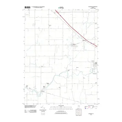
2010 Map of Waldron
USGS Topo · Published 2010About this map
The Flatrock River carves a winding path through this corner of Indiana, defining the geography for settlements like Saint Paul and Germantown. The landscape is dominated by a grid of rural roads and small communities, including the central hub of Waldron and the smaller hamlets of Middletown, Morven, and Geneva. A significant diagonal corridor is formed by E Michigan Rd, which cuts across the traditional section lines, linking these rural outposts.
Find a feature on this map
67 named features on this map. Tap any name to fly to it.
Don’t see what you’re looking for? This feature index may not catch every label — zoom into the map to look around manually.
Map Details
Editions of this 2010 Waldron Map
This is the sole edition of this map. No revisions or reprints were ever made.
Other maps of this area

1942 · Columbus
USGS Topo · 1:125,000
1947 · Hope
USGS Topo · 1:24,000
1948 · Hope
USGS Topo · 1:24,000
1948 · Lewis Creek
USGS Topo · 1:24,000

1950 · Edinburg
USGS Topo · 1:62,500
1953 · Shelbyville
USGS Topo · 1:24,000

1953 · Cincinnati
USGS Topo · 1:250,000
1956 · Waldron
USGS Topo · 1:24,000
1956 · Rays Crossing
USGS Topo · 1:24,000

1957 · Cincinnati
USGS Topo · 1:250,000