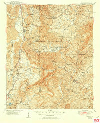
1950 Map of Waleska
USGS Topo · Published 1950About this map
The Louisville and Nashville railroad corridor serves as the primary artery through this North Georgia landscape, connecting the settlements of Fairmount, Bolivar, and Rydal. In the era following the Second World War, the region's economy shows its transition from agricultural milling to emerging industries, evidenced by the presence of Pinhook Mill and Erwin Mill alongside the Flexatile facility. The terrain is dominated by the ridges of Pine Log Mountain and peaks like Sharp Top Mtn, which define the drainage of Salacoa Creek and Shoal Creek. Community life is anchored by a dense network of rural landmarks, including the County Home, numerous schools such as Garland Sch, and churches like Tabernacle Ch and Brier Patch Ch. This survey provides a clear view of the rural infrastructure in Cherokee, Pickens, Gordon, and Bartow counties before modern expansion, capturing the placement of family-named landmarks like McCanless Creek and Cagle Min.
Find a feature on this map
107 named features on this map. Tap any name to fly to it.
Don’t see what you’re looking for? This feature index may not catch every label — zoom into the map to look around manually.
Map Details
Editions of this 1950 Waleska Map
2 editions found
Other maps of this area

1886 · Dalton
USGS Topo · 1:125,000

1888 · Ellijay
USGS Topo · 1:125,000

1890 · Suwanee
USGS Topo · 1:125,000

1890 · Cartersville
USGS Topo · 1:125,000

1891 · Cartersville
USGS Topo · 1:125,000

1892 · Ellijay
USGS Topo · 1:125,000

1892 · Dalton
USGS Topo · 1:125,000

1894 · Suwanee
USGS Topo · 1:125,000

1896 · Cartersville
USGS Topo · 1:125,000

1897 · Dalton
USGS Topo · 1:125,000