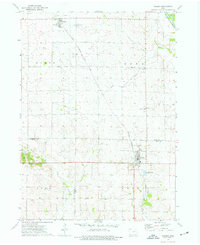
1973 Map of Walker
USGS Topo · Published 1977About this map
Walker and Rowley anchor this Iowa landscape during the mid-1970s, situated along the diagonal corridor of the Chicago Rock Island and Pacific railroad. The map documents a rural transition where traditional landmarks like the Presbyterian Ch and Christian Sch exist alongside modern infrastructure, including several Sewage Disposal Ponds near the town centers. The terrain is defined by the Wapsipinicon River in the northeast corner and the branching networks of Sand Creek and Blue Creek, which divide the rolling acreage of Cono, Homer, and Grant townships.
Find a feature on this map
26 named features on this map. Tap any name to fly to it.
Don’t see what you’re looking for? This feature index may not catch every label — zoom into the map to look around manually.
Map Details
Editions of this 1973 Walker Map
2 editions found
Other maps of this area

1888 · Shellsburg
USGS Topo · 1:62,500

1888 · Marion
USGS Topo · 1:62,500

1889 · Marion
USGS Topo · 1:62,500

1889 · Shellsburg
USGS Topo · 1:62,500

1899 · Shellsburg
USGS Topo · 1:62,500

1903 · Winthrop
USGS Topo · 1:125,000

1959 · Dubuque
USGS Topo · 1:250,000

1961 · Dubuque
USGS Topo · 1:250,000

1962 · Dubuque
USGS Topo · 1:250,000
1968 · Lafayette
USGS Topo · 1:24,000