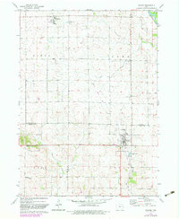
1973 Map of Walker
USGS Topo · Published 1983About this map
Walker serves as the primary hub of this agricultural region where the borders of Buchanan, Benton, and Linn Counties converge. The landscape is defined by the winding course of the Wapsipinicon River in the northeast and several small tributaries including Sand Creek, Blue Creek, and Smith Creek. The town of Rowley sits in the northwest corner, while the small settlement of Spencers Grove is positioned further south, providing a detailed look at the rural township structures of Homer, Cono, Polk, and Grant during the early 1970s.
Find a feature on this map
28 named features on this map. Tap any name to fly to it.
Don’t see what you’re looking for? This feature index may not catch every label — zoom into the map to look around manually.
Map Details
Editions of this 1973 Walker Map
2 editions found
Other maps of this area

1888 · Shellsburg
USGS Topo · 1:62,500

1888 · Marion
USGS Topo · 1:62,500

1889 · Marion
USGS Topo · 1:62,500

1889 · Shellsburg
USGS Topo · 1:62,500

1899 · Shellsburg
USGS Topo · 1:62,500

1903 · Winthrop
USGS Topo · 1:125,000

1959 · Dubuque
USGS Topo · 1:250,000

1961 · Dubuque
USGS Topo · 1:250,000

1962 · Dubuque
USGS Topo · 1:250,000
1968 · Lafayette
USGS Topo · 1:24,000