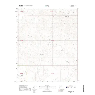
2020 Map of Walker Canyon
USGS Topo · Published 2020About this map
High Lonesome Peak anchors the eastern edge of this southwestern New Mexico landscape, a region defined by complex drainage systems and severe vertical relief. The land is dissected by numerous named canyons such as Walker Canyon, Elliot Canyon, and Redrock Canyon, which funnel seasonal runoff toward the drainage of Blue Cr and Little Sycamore Cr. The arid character of the high desert is evidenced by isolated water features like Walker Tank and the presence of Mud Springs Draw in the south near Davenport Canyon.
Find a feature on this map
26 named features on this map. Tap any name to fly to it.
Don’t see what you’re looking for? This feature index may not catch every label — zoom into the map to look around manually.
Map Details
Editions of this 2020 Walker Canyon Map
This is the sole edition of this map. No revisions or reprints were ever made.
Other maps of this area

1954 · Silver City
USGS Topo · 1:250,000

1958 · Silver City
USGS Topo · 1:250,000

1959 · Steeple Rock
USGS Topo · 1:62,500

1959 · Redrock
USGS Topo · 1:62,500

1959 · Canador Peak
USGS Topo · 1:62,500

1959 · Cliff
USGS Topo · 1:62,500

1962 · Silver City
USGS Topo · 1:250,000
1990 · Crookson Peak
USGS Topo · 1:24,000
1990 · Antelope Ridge
USGS Topo · 1:24,000
1990 · Walker Canyon
USGS Topo · 1:24,000