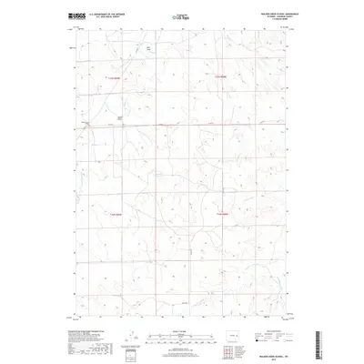
2017 Map of Walker Creek School
USGS Topo · Published 2017About this map
Walker Creek School stands as a focal point in this high-plains landscape of Converse County, marking a site of community importance within a network of drainage basins. The area is defined by its seasonal watercourses, including Walker Cr and its S Fork Walker Cr, alongside Piney Cr and Cottonwood Cr. The presence of the Herrick Reservoir indicates the critical role of water management in this Wyoming environment. Public land survey boundaries for t35n r69w and surrounding townships overlay a terrain marked by geographic features like Gould Draw. This 2017 survey by the U.S. Geological Survey details the rural road system, including Co RD 53 and Dickau Rd, which navigate the various forks of Twentymile Cr and the undulating plains of eastern Wyoming.
Find a feature on this map
18 named features on this map. Tap any name to fly to it.
Don’t see what you’re looking for? This feature index may not catch every label — zoom into the map to look around manually.
Map Details
Editions of this 2017 Walker Creek School Map
This is the sole edition of this map. No revisions or reprints were ever made.
Other maps of this area

1954 · Torrington
USGS Topo · 1:250,000

1955 · Newcastle
USGS Topo · 1:250,000

1958 · Torrington
USGS Topo · 1:250,000

1958 · Newcastle
USGS Topo · 1:250,000

1970 · Lost Springs
USGS Topo · 1:24,000
1970 · The Park
USGS Topo · 1:24,000

1970 · Bill 4 SE
USGS Topo · 1:24,000

1970 · Walker Creek School
USGS Topo · 1:24,000
1970 · Simpson Draw
USGS Topo · 1:24,000

1970 · Lost Springs NW
USGS Topo · 1:24,000