
1957 Map of Walker Lake
USGS Topo · Published 1957About this map
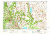
The high desert basins and peaks of the Nevada-California borderlands define this mid-century landscape, dominated by the prominent blue expanse of Walker Lake and the northern reaches of Mono Lake. Settlement patterns follow the precious water of the Carson River and Walker River valleys, where towns like Minden, Gardnerville, and Yerington serve as regional hubs. The era's industrial footprint is visible in the network of the Southern Pacific railroad and the remote mining operations at Leviathan Sulphur Mine and Rockland Mines. Cultural boundaries are clearly marked, from the Walker River Indian Reservation to the vast tracts of the Toiyabe National Forest and the high Sierra peaks within Yosemite National Park. Notable for genealogists is the presence of several established mining and ranching settlements, including Bodie, Luning, and the salt-crusted flats of the Columbus Salt Marsh.
Find a feature on this map
102 named features on this map. Tap any name to fly to it.
Don’t see what you’re looking for? This feature index may not catch every label — zoom into the map to look around manually.
Map Details
Editions of this 1957 Walker Lake Map
4 editions found
Other maps of this area

1889 · Pyramid Peak
USGS Topo · 1:125,000

1889 · Markleeville
USGS Topo · 1:125,000

1891 · Carson
USGS Topo · 1:125,000

1891 · Markleeville
USGS Topo · 1:125,000

1891 · Truckee
USGS Topo · 1:125,000

1891 · Big Trees
USGS Topo · 1:125,000

1891 · Wabuska
USGS Topo · 1:125,000

1891 · Pyramid Peak
USGS Topo · 1:125,000

1891 · Wellington
USGS Topo · 1:125,000

1893 · Carson
USGS Topo · 1:125,000