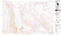
1985 Map of Walker Lake
USGS Topo · Published 1985About this map
Walker Lake dominates this mid-1980s landscape, flanked by the massive Wassuk Range to the west and the Gillis Range to the east. The southern end of the lake is defined by the significant footprint of the Hawthorne Ammunition Depot, with its dense network of storage bunkers and rail lines, alongside the town of Hawthorne and the community of Babbitt. To the north, the Walker River snakes through the Walker River Indian Reservation past the settlement of Schurz.
Find a feature on this map
73 named features on this map. Tap any name to fly to it.
Don’t see what you’re looking for? This feature index may not catch every label — zoom into the map to look around manually.
Map Details
Editions of this 1985 Walker Lake Map
2 editions found
Other maps of this area

1891 · Wabuska
USGS Topo · 1:125,000

1891 · Wellington
USGS Topo · 1:125,000

1893 · Wellington
USGS Topo · 1:125,000

1894 · Wabuska
USGS Topo · 1:125,000

1907 · Tonopah
USGS Topo · 1:250,000

1908 · Tonopah
USGS Topo · 1:250,000

1908 · Carson Sink
USGS Topo · 1:250,000

1909 · Hawthorne
USGS Topo · 1:250,000

1909 · Bridgeport
USGS Topo · 1:125,000

1910 · Carson Sink
USGS Topo · 1:250,000