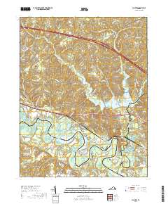
2019 Map of Walkers
USGS Topo · Published 2019About this map
Chickahominy River winding through the coastal plain defines the geography of this Tidewater region, where the river's broad bends create prominent landforms like Matahunk Neck, Turner Neck, and Wilcox Neck. The landscape is a complex network of waterways, including the substantial Diascund Reservoir and its namesake Diascund Cr, which flows south toward the Diascund Bridge.
Find a feature on this map
127 named features on this map. Tap any name to fly to it.
Don’t see what you’re looking for? This feature index may not catch every label — zoom into the map to look around manually.
Map Details
Editions of this 2019 Walkers Map
This is the sole edition of this map. No revisions or reprints were ever made.
Other maps of this area

1917 · Toano
USGS Topo · 1:62,500

1918 · Charles City
USGS Topo · 1:62,500

1918 · Toano
USGS Topo · 1:62,500

1919 · New Kent
USGS Topo · 1:62,500

1920 · King William
USGS Topo · 1:62,500

1943 · Richmond
USGS Topo · 1:250,000

1949 · Tunstall
USGS Topo · 1:24,000

1949 · New Kent
USGS Topo · 1:24,000

1949 · Richmond
USGS Topo · 1:250,000

1950 · West Point
USGS Topo · 1:24,000