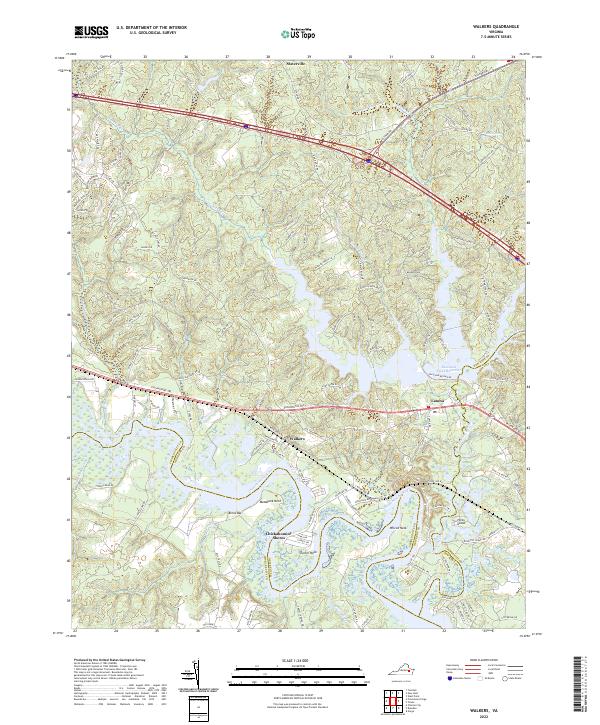
2022 Map of Walkers
USGS Topo · Published 2022About this map
The Chickahominy River defines the southern reach of this landscape, its winding course forming the border between Charles City and New Kent counties. This modern topographic view reveals the intricate shoreline of Matahunk Neck, Turner Neck, and Wilcox Neck, where the river's loops and marshes meet small landings like Binns Bar. To the east, the Diascund Creek Reservoir serves as a major geographical feature, created by the damming of Diascund Creek.
Find a feature on this map
121 named features on this map. Tap any name to fly to it.
Don’t see what you’re looking for? This feature index may not catch every label — zoom into the map to look around manually.
Map Details
Editions of this 2022 Walkers Map
This is the sole edition of this map. No revisions or reprints were ever made.
Other maps of this area

1917 · Toano
USGS Topo · 1:62,500

1918 · Charles City
USGS Topo · 1:62,500

1918 · Toano
USGS Topo · 1:62,500

1919 · New Kent
USGS Topo · 1:62,500

1920 · King William
USGS Topo · 1:62,500

1943 · Richmond
USGS Topo · 1:250,000

1949 · Tunstall
USGS Topo · 1:24,000

1949 · New Kent
USGS Topo · 1:24,000

1949 · Richmond
USGS Topo · 1:250,000

1950 · West Point
USGS Topo · 1:24,000