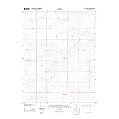
2013 Map of Walks Camp Park
USGS Topo · Published 2013About this map
Walks Camp Park centers this portion of the High Plains in Lincoln County, where the arid landscape is defined by the ephemeral drainages of the Arikaree River and its northern branch, the N Fork Arikaree River. The map reveals a sparse, rural settlement pattern typical of the eastern Colorado plains, organized around a rigid grid of county roads. Genealogical interest is anchored by two distinct burial sites: the Walks Camp Cem to the west and the Walks Camp Lutheran Cem near the northern boundary. These landmarks, along with intermittent creek beds like Lickdab Cr and Currie Cr, trace the history of dryland ranching and community life in a region where water sources and family legacies were the primary drivers of settlement.
Find a feature on this map
29 named features on this map. Tap any name to fly to it.
Don’t see what you’re looking for? This feature index may not catch every label — zoom into the map to look around manually.
Map Details
Editions of this 2013 Walks Camp Park Map
This is the sole edition of this map. No revisions or reprints were ever made.
Other maps of this area

1891 · Limon
USGS Topo · 1:125,000

1892 · Limon
USGS Topo · 1:125,000

1954 · Limon
USGS Topo · 1:250,000

1957 · Limon
USGS Topo · 1:250,000

1958 · Limon
USGS Topo · 1:250,000

1970 · Limon
USGS Topo · 1:24,000

1970 · T Draw
USGS Topo · 1:24,000

1973 · Last Chance SW
USGS Topo · 1:24,000

1973 · Lusto Springs
USGS Topo · 1:24,000

1973 · Lindon SW
USGS Topo · 1:24,000