
1960 Map of Wall
USGS Topo · Published 1961About this map
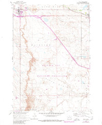
The rugged topography of the Badlands National Monument defines the southern portion of this landscape, where the broken terrain gives way to the open reaches of Conata and Bloom Basin. Settled along the northern edge, the town of Wall stands as a primary hub, marked by its Landing Field and proximity to the Chicago and North Western line. This railroad corridor remains a critical artery for the region, connecting Wall to the smaller settlement of Quinn to the east.
Find a feature on this map
20 named features on this map. Tap any name to fly to it.
Don’t see what you’re looking for? This feature index may not catch every label — zoom into the map to look around manually.
Map Details
Editions of this 1960 Wall Map
2 editions found
Other maps of this area

1953 · Rapid City
USGS Topo · 1:250,000

1954 · Wasta SE
USGS Topo · 1:24,000

1955 · Hot Springs
USGS Topo · 1:250,000

1957 · Rapid City
USGS Topo · 1:250,000

1960 · Quinn Table NE
USGS Topo · 1:24,000

1960 · Wall SE
USGS Topo · 1:24,000

1960 · Quinn Table SE
USGS Topo · 1:24,000
1960 · Wall SW
USGS Topo · 1:24,000
1961 · Wall NE
USGS Topo · 1:24,000

1981 · Wall
USGS Topo · 1:100,000