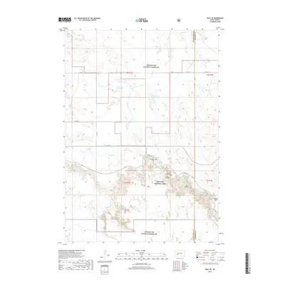
2017 Map of Wall SE
USGS Topo · Published 2017About this map
Badlands National Park and Buffalo Gap National Grassland meet in this 2017 survey of western South Dakota, where the transition from high prairie to weathered geological formations is sharply defined. The terrain is characterized by intricate drainage systems such as Kimball Cr and Big Foot Cr, which have carved deep into the landscape to form notable landmarks like The Castle. Water management in this arid environment is evident through several small impoundments, including Missile 249 Reservoir and Big Foot Pass Reservoir.
Find a feature on this map
19 named features on this map. Tap any name to fly to it.
Don’t see what you’re looking for? This feature index may not catch every label — zoom into the map to look around manually.
Map Details
Editions of this 2017 Wall SE Map
This is the sole edition of this map. No revisions or reprints were ever made.
Other maps of this area

1950 · Conata
USGS Topo · 1:24,000

1950 · Interior
USGS Topo · 1:24,000

1952 · Conata NE
USGS Topo · 1:24,000

1952 · Conata
USGS Topo · 1:24,000

1955 · Hot Springs
USGS Topo · 1:250,000

1955 · Martin
USGS Topo · 1:250,000

1958 · Martin
USGS Topo · 1:250,000

1960 · Wall SE
USGS Topo · 1:24,000

1960 · Wall
USGS Topo · 1:24,000

1960 · Cottonwood SW
USGS Topo · 1:24,000