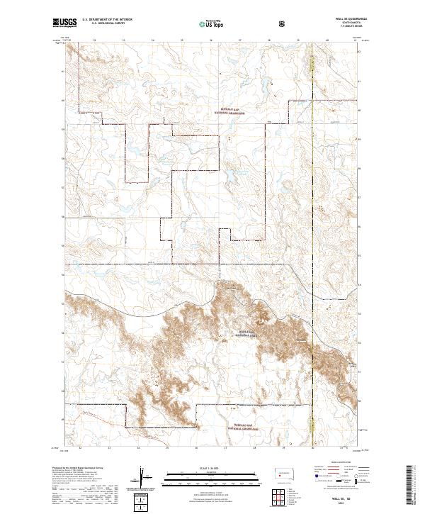
2021 Map of Wall SE
USGS Topo · Published 2021About this map
Badlands National Park and the surrounding Buffalo Gap National Grassland create a landscape of sharp elevation changes and deep seasonal drainages in this 2021 survey of the Pennington and Jackson County border. The map illustrates the transition from the relatively level grazing lands of the north to the heavily eroded geological formations of the south, anchored by prominent features like The Castle.
Find a feature on this map
21 named features on this map. Tap any name to fly to it.
Don’t see what you’re looking for? This feature index may not catch every label — zoom into the map to look around manually.
Map Details
Editions of this 2021 Wall SE Map
This is the sole edition of this map. No revisions or reprints were ever made.
Other maps of this area

1950 · Conata
USGS Topo · 1:24,000

1950 · Interior
USGS Topo · 1:24,000

1952 · Conata NE
USGS Topo · 1:24,000

1952 · Conata
USGS Topo · 1:24,000

1955 · Hot Springs
USGS Topo · 1:250,000

1955 · Martin
USGS Topo · 1:250,000

1958 · Martin
USGS Topo · 1:250,000

1960 · Wall SE
USGS Topo · 1:24,000

1960 · Wall
USGS Topo · 1:24,000

1960 · Cottonwood SW
USGS Topo · 1:24,000