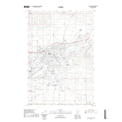
2020 Map of Walla Walla
USGS Topo · Published 2020About this map
Walla Walla and College Place define the center of this 2020 landscape, where the urban grid meets the agricultural reaches of southeastern Washington. The map provides a contemporary view of longtime institutions, including the campus of Whitman College and the sprawling grounds of Fort Walla Walla Military Gardens. Genealogy and local history are particularly well-represented through the detailed positioning of Walla Walla Military Cem, Mountain View Cem, and Blue Mountain Memorial Gardens.
Find a feature on this map
142 named features on this map. Tap any name to fly to it.
Don’t see what you’re looking for? This feature index may not catch every label — zoom into the map to look around manually.
Map Details
Editions of this 2020 Walla Walla Map
This is the sole edition of this map. No revisions or reprints were ever made.
Other maps of this area

1919 · Walla Walla
USGS Topo · 1:125,000

1921 · Walla Walla
USGS Topo · 1:125,000

1953 · Pendleton
USGS Topo · 1:250,000

1953 · Walla Walla
USGS Topo · 1:250,000

1956 · Pendleton
USGS Topo · 1:250,000

1958 · Walla Walla
USGS Topo · 1:250,000

1963 · Peterson Ridge
USGS Topo · 1:24,000

1964 · Milton-Freewater
USGS Topo · 1:24,000

1964 · Bowlus Hill
USGS Topo · 1:24,000

1966 · Dixie
USGS Topo · 1:24,000