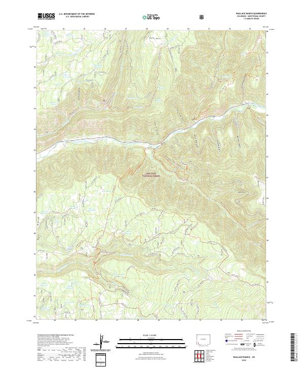
2022 Map of Wallace Ranch
USGS Topo · Published 2022About this map
The Dolores River cuts through the center of this landscape, carving a route through the high terrain of the San Juan National Forest. This 2022 survey reveals a complex network of resource management and historical activity, marked by an extensive system of water catchments like Bauer Reservoir, Taylor Mesa Reservoir, and Black Reservoir. These features, alongside numerous springs such as Siphon Spring and Calico Spring, point to the critical role of water infrastructure in this part of Montezuma County.
Find a feature on this map
94 named features on this map. Tap any name to fly to it.
Don’t see what you’re looking for? This feature index may not catch every label — zoom into the map to look around manually.
Map Details
Editions of this 2022 Wallace Ranch Map
This is the sole edition of this map. No revisions or reprints were ever made.
Other maps of this area

1895 · La Plata
USGS Topo · 1:62,500

1897 · La Plata
USGS Topo · 1:62,500

1897 · Rico
USGS Topo · 1:62,500

1898 · Rico
USGS Topo · 1:62,500

1899 · La Plata
USGS Topo · 1:62,500

1899 · Rico
USGS Topo · 1:62,500

1908 · La Plata
USGS Topo · 1:62,500

1956 · Cortez
USGS Topo · 1:250,000

1958 · Cortez
USGS Topo · 1:250,000

1959 · Cortez
USGS Topo · 1:250,000