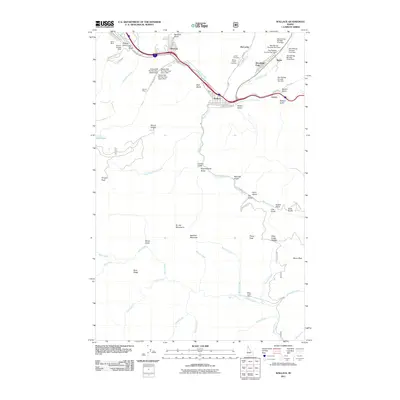
2011 Map of Wallace
USGS Topo · Published 2011About this map
Wallace and Silverton sit within the narrow corridor of the South Fork Coeur d'Alene River valley, a landscape defined by its deep mining history. The map documents an extensive industrial network of mineral extraction and waste management, specifically naming numerous structures like the Galena Mill Number Two-Middle Dam and the series of Star Tailings Number One Dam sites north of Woodland Park. These tailings dams and the prominent Galena Mine illustrate the long-term environmental and economic footprint of the Silver Valley. Beyond the industrial zones, the terrain rises sharply into the St. Joe Mountains, where features like Placer Peak and Bad Tom Mountain overlook a network of remote drainages. Small settlements like Gentry and Webb are linked by canyon roads, while the Miners Union Cemetery near McCarthy provides a poignant connection to the local labor history of the Idaho panhandle.
Find a feature on this map
70 named features on this map. Tap any name to fly to it.
Don’t see what you’re looking for? This feature index may not catch every label — zoom into the map to look around manually.
Map Details
Editions of this 2011 Wallace Map
This is the sole edition of this map. No revisions or reprints were ever made.
Other maps of this area

1901 · Coeur D'Alene District
USGS Topo · 1:62,500

1903 · Coeur D'Alene District
USGS Topo · 1:62,500

1906 · Coeur D'Alene District
USGS Topo · 1:62,500

1909 · Cataldo
USGS Topo · 1:125,000

1911 · Cataldo
USGS Topo · 1:125,000

1914 · Avery
USGS Topo · 1:125,000

1917 · Avery
USGS Topo · 1:125,000

1932 · Trout Creek
USGS Topo · 1:125,000

1935 · Trout Creek
USGS Topo · 1:125,000

1936 · Trout Creek
USGS Topo · 1:125,000