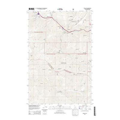
2013 Map of Wallace
USGS Topo · Published 2013About this map
The S Fork Coeur d'Alene River valley forms the industrial and residential backbone of this Shoshone County corridor, where the historic mining town of Wallace sits at the confluence of several steep drainages. Dense settlement patterns follow the canyon floors through Woodland Park, Silverton, and Osburn, revealing how geography dictated the growth of these Silver Valley communities. The rugged transition between the Coeur d'Alene National Forest and the St Joe National Forest is marked by prominent peaks like Mt Pulaski and the high St Joe Mountains to the south.
Find a feature on this map
77 named features on this map. Tap any name to fly to it.
Don’t see what you’re looking for? This feature index may not catch every label — zoom into the map to look around manually.
Map Details
Editions of this 2013 Wallace Map
This is the sole edition of this map. No revisions or reprints were ever made.
Other maps of this area

1901 · Coeur D'Alene District
USGS Topo · 1:62,500

1903 · Coeur D'Alene District
USGS Topo · 1:62,500

1906 · Coeur D'Alene District
USGS Topo · 1:62,500

1909 · Cataldo
USGS Topo · 1:125,000

1911 · Cataldo
USGS Topo · 1:125,000

1914 · Avery
USGS Topo · 1:125,000

1917 · Avery
USGS Topo · 1:125,000

1932 · Trout Creek
USGS Topo · 1:125,000

1935 · Trout Creek
USGS Topo · 1:125,000

1936 · Trout Creek
USGS Topo · 1:125,000