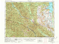
1956 Map of Wallace
USGS Topo · Published 1982About this map
Wallace and the silver-mining district of northern Idaho serve as the western anchor for this mid-century survey, which tracks the corridor of U.S. 10 across the Bitterroot Range into Montana. The landscape is dominated by a succession of protected lands, including the Kaniksu National Forest and Lolo National Forest, where the topography is defined by the Buffalo Bill Divide and the St Regis River. The eastern portion of the map is centered on the Flathead Indian Reservation and the southern reaches of Flathead Lake, featuring shoreline developments like Wild Horse Island State Park and the town of Polson.
Find a feature on this map
246 named features on this map. Tap any name to fly to it.
Don’t see what you’re looking for? This feature index may not catch every label — zoom into the map to look around manually.
Map Details
Editions of this 1956 Wallace Map
3 editions found

Other maps of this area

1901 · Coeur D'Alene District
USGS Topo · 1:62,500

1903 · Bonner
USGS Topo · 1:125,000

1903 · Coeur D'Alene District
USGS Topo · 1:62,500

1906 · Coeur D'Alene District
USGS Topo · 1:62,500

1909 · Cataldo
USGS Topo · 1:125,000

1911 · Cataldo
USGS Topo · 1:125,000

1911 · Priest Lake
USGS Topo · 1:250,000

1911 · Lolo
USGS Topo · 1:250,000

1912 · Missoula
USGS Topo · 1:125,000

1913 · Lolo
USGS Topo · 1:250,000