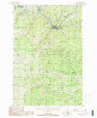
1988 Map of Wallace
USGS Topo · Published 1988About this map
Wallace serves as the industrial and civic anchor for this mountain landscape, positioned along the South Fork Coeur D'Alene River corridor. The 1980s terrain is heavily marked by its mineral heritage, showing substantial infrastructure like the Galena Mine, St Elmo Mine, and Callahan Mine. The heavy industrial footprint of the Silver Valley is evident in the presence of extensive Tailings Ponds near Silverton and Osburn, illustrating the environmental scale of local mining operations.
Find a feature on this map
50 named features on this map. Tap any name to fly to it.
Don’t see what you’re looking for? This feature index may not catch every label — zoom into the map to look around manually.
Map Details
Editions of this 1988 Wallace Map
This is the sole edition of this map. No revisions or reprints were ever made.
Other maps of this area

1901 · Coeur D'Alene District
USGS Topo · 1:62,500

1903 · Coeur D'Alene District
USGS Topo · 1:62,500

1906 · Coeur D'Alene District
USGS Topo · 1:62,500

1909 · Cataldo
USGS Topo · 1:125,000

1911 · Cataldo
USGS Topo · 1:125,000

1914 · Avery
USGS Topo · 1:125,000

1917 · Avery
USGS Topo · 1:125,000

1932 · Trout Creek
USGS Topo · 1:125,000

1935 · Trout Creek
USGS Topo · 1:125,000

1936 · Trout Creek
USGS Topo · 1:125,000