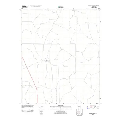
2010 Map of Waller Ranch
USGS Topo · Published 2010About this map
Waller Ranch serves as the central hub of this Torrance County landscape, situated at a junction of rural routes during the early 21st century. The geography is defined by a modest network of local thoroughfares, including Waller Ranch Rd and County Rd C106e, which connect the isolated ranching operations characteristic of this region. To the south, the terrain includes Red Hill, another named landmark that anchors the sparsely populated area. This document captures the spatial arrangement of a modern New Mexico ranching environment, illustrating the vast distances between named settlements and the critical role of these local road systems in maintaining the connectivity of the high plains ranching economy.
Find a feature on this map
4 named features on this map. Tap any name to fly to it.
Don’t see what you’re looking for? This feature index may not catch every label — zoom into the map to look around manually.
Map Details
Editions of this 2010 Waller Ranch Map
This is the sole edition of this map. No revisions or reprints were ever made.
Other maps of this area

1890 · Bernal
USGS Topo · 1:125,000

1891 · Bernal
USGS Topo · 1:125,000

1894 · Bernal
USGS Topo · 1:125,000

1894 · Lamy
USGS Topo · 1:125,000

1954 · Santa Fe
USGS Topo · 1:250,000

1954 · Fort Sumner
USGS Topo · 1:250,000

1958 · Fort Sumner
USGS Topo · 1:250,000

1958 · Santa Fe
USGS Topo · 1:250,000

1963 · Jacinto Mesa
USGS Topo · 1:24,000
1966 · El Cabo
USGS Topo · 1:24,000