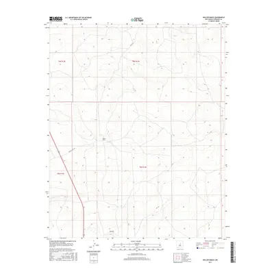
2017 Map of Waller Ranch
USGS Topo · Published 2017About this map
Waller Ranch and the prominence of Red Hill serve as the primary landmarks in this sparsely settled region of Torrance County. The terrain is defined by a series of north-south trending ridges and drainages, where elevation contours reveal a landscape shaped by intermittent water flow and cattle ranching activity. Development is centered on local transport routes such as Waller Ranch Rd and Co Rd C106, which navigate the township lines of T9N and T8N. The mapping of these ranch lands and natural features highlights the enduring agricultural character of central New Mexico, providing a record of land use and property boundaries within the public land survey system.
Find a feature on this map
8 named features on this map. Tap any name to fly to it.
Don’t see what you’re looking for? This feature index may not catch every label — zoom into the map to look around manually.
Map Details
Editions of this 2017 Waller Ranch Map
This is the sole edition of this map. No revisions or reprints were ever made.
Other maps of this area

1890 · Bernal
USGS Topo · 1:125,000

1891 · Bernal
USGS Topo · 1:125,000

1894 · Bernal
USGS Topo · 1:125,000

1894 · Lamy
USGS Topo · 1:125,000

1954 · Santa Fe
USGS Topo · 1:250,000

1954 · Fort Sumner
USGS Topo · 1:250,000

1958 · Fort Sumner
USGS Topo · 1:250,000

1958 · Santa Fe
USGS Topo · 1:250,000

1963 · Jacinto Mesa
USGS Topo · 1:24,000
1966 · El Cabo
USGS Topo · 1:24,000